 Climaviso
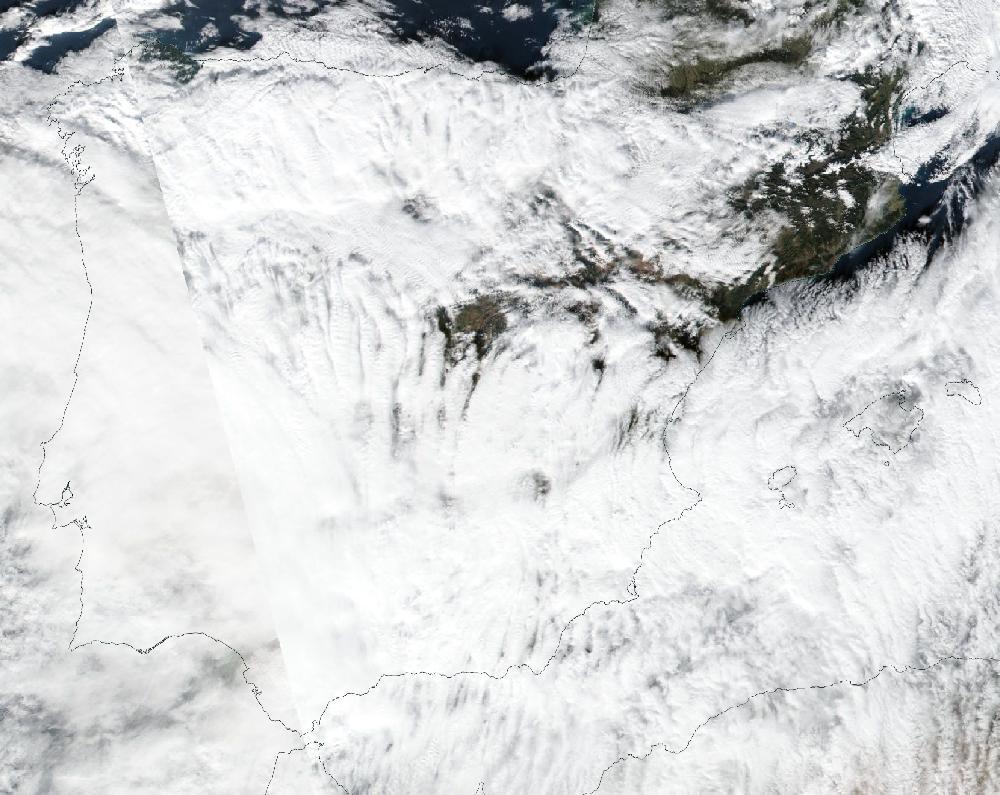
Storms Daniel and Fabien: wind across much of Spain, 16–22 December 2019
16 December 2019 to 22 December 2019. Updated 26 October 2026.
AEMET named this storm Daniel on 15 December 2019. It coincides with storm Elsa, named by IPMA on 16 December 2019. AEMET named this storm Fabien on 18 December 2019.
Over 7 days, 126 of Spain's 182 warning zones had an orange or red warning for wind: 306 zone-days at orange or red, 5 of them red. The day with the most zones at orange or red was 20 December, with 81 zones.
20 December was the day with the most people in zones under an orange or red warning: 17 million people live there (INE municipal register, 2025).
How it compares
- It is number 6 of 119 episodes since June 2018 by zone-days at orange or red.
- It is the largest of the 26 wind episodes since June 2018.
Day by day
| Day | Red | Orange | Yellow | Orange or red warnings for |
|---|---|---|---|---|
| Mon 16 December | — | 15 | 60 | wind, snow |
| Tue 17 December | — | 5 | 29 | snow |
| Wed 18 December | — | 13 | 28 | wind, rain |
| Thu 19 December | — | 79 | 38 | wind, rain |
| Fri 20 December | — | 81 | 56 | wind, rain |
| Sat 21 December | 3 | 72 | 66 | wind, rain |
| Sun 22 December | 2 | 36 | 81 | wind |
Zones with a warning each day, at their highest level that day.
The zones
And 51 more zones with yellow warnings only.
What AEMET's stations measured
The most measured in the zones with an orange or red warning, on their warning days: a 188 km/h gust at Estaca de Bares (Noroeste de A Coruña) on 21 December.
| Zone | Strongest gust |
|---|---|
| Noroeste de A Coruña | 188 km/h Estaca de Bares · 21 December |
| Ibérica riojana | 180 km/h Valdezcaray · 21 December |
| Bizkaia litoral | 174 km/h Matxitxako · 22 December |
| Pirineo oscense | 168 km/h Cerler, Cogulla · 20 December |
| Sistema Central de Segovia | 155 km/h La Pinilla, Estación de Esquí · 20 December |
| Cordillera Cantábrica de Palencia | 149 km/h Velilla del Río Carrión, Camporredondo de Alba · 19 December |
| Centro y valle de Villaverde | 136 km/h Alto Campoo · 18 December |
| Cordillera y Picos de Europa | 133 km/h Cabrales · 19 December |
| Sur de Badajoz | 132 km/h Fuente de Cantos · 16 December |
| Bajo Aragón de Teruel | 131 km/h Andorra, Horcallana · 21 December |
| Centro de Navarra | 128 km/h Monreal/elo · 20 December |
| Suroccidental asturiana | 128 km/h Ibias, San Antolin · 21 December |
| Norte de Burgos | 124 km/h Medina de Pomar · 19 December |
| Montaña de Ourense | 123 km/h Chandrexa de Queixa · 19 December |
| Sistema Central de Soria | 122 km/h La Riba de Escalote · 20 December |
| Sistema Central de Ávila | 120 km/h Muñotello · 16 December |
| Gipuzkoa litoral | 119 km/h Donostia / San Sebastián, Igeldo · 20 December |
| Meseta cacereña | 119 km/h Valencia de Alcántara · 19 December |
| Meseta de Soria | 118 km/h Burgo de Osma · 21 December |
| Meseta de Segovia | 117 km/h Aldeanueva de Serrezuela · 21 December |
And 106 more zones with an orange or red warning.
For each zone, the highest value its AEMET stations measured on the episode's warning days (the lowest, for the low temperature), with the station and the day. Rain from 07:00 to 07:00 UTC; gust: the day's strongest. It is what the zone's stations measured, not every town, and a measurement, like a warning, is not damage.
How AEMET's warnings unfolded
The red warning reached 5 zone-days, and AEMET always issued it ahead of time (median: 28 h). The first warning of any level for those same days had come a median 36 h earlier.
| Zone | Day | First warning | Red issued | For · notice |
|---|---|---|---|---|
| A Mariña | Sat 21 | Wed 18 Dec, 23:50 yellow | Fri 20 Dec, 11:22 | 15:00 · 28 h before |
| Noroeste de A Coruña | Sat 21 | Wed 18 Dec, 23:50 yellow | Fri 20 Dec, 11:22 | 15:00 · 28 h before |
| Suroccidental asturiana | Sat 21 | Wed 18 Dec, 23:50 orange | Fri 20 Dec, 21:46 | 15:00 · 17 h before |
| A Mariña | Sun 22 | Thu 19 Dec, 23:50 orange | Fri 20 Dec, 11:34 | 00:00 · 36 h before |
| Noroeste de A Coruña | Sun 22 | Thu 19 Dec, 23:50 yellow | Fri 20 Dec, 11:34 | 00:00 · 36 h before |
The full timeline: 493 changes at orange or red
Only the changes involving red are listed: there were 493 in all.
Fri 20 December
- A Mariña, Noroeste de A Coruña: Raises the wind warning to red: Saturday 21, 15:00–24:00. Gusts up to 140 km/h.
- A Mariña: Raises the wind warning to red: Sunday 22, 00:00–04:00. Gusts up to 140 km/h.
- Noroeste de A Coruña: Raises the wind warning to red: Sunday 22, 00:00–04:00. Gusts up to 140 km/h.
- Noroeste de A Coruña: Lowers the wind warning to orange: Saturday 21, 06:00–24:00. Gusts up to 110 km/h.
- Suroccidental asturiana: Raises the wind warning to red: Saturday 21, 15:00–24:00. Gusts up to 140 km/h.
- A Mariña, Noroeste de A Coruña: Lowers the wind warning to orange: Sunday 22, 00:00–12:00. Gusts up to 110 km/h.
Sat 21 December
- Noroeste de A Coruña: Raises the wind warning to red: Saturday 21, 15:00–24:00. Gusts up to 140 km/h.
AEMET's issue times, in mainland Spain time (Canary Islands in island time). Notice is the time from issue to the first hour the warning covered; a warning issued “for the current hour” runs from the hour it is published.
What this says and what it doesn't
A warning is an AEMET forecast, not a measurement or a damage report: it says a threshold is expected to be exceeded in a zone. A warning is not damage; a zone is not a building.
A zone-day is one warning zone with a warning on one day. Ten zones at orange on the same day make ten zone-days. A day with several warnings in one zone counts once, at its highest level.
Each zone has its own thresholds, so an orange heat warning in Asturias doesn't mean the same temperature as in Córdoba. More in how warnings work.
To cite: “Climaviso, from AEMET warnings”.
Source: official AEMET warnings, collected by Climaviso since June 2018.
← Previous episode · All episodes · Next episode → · 2019 warnings review