 Climaviso
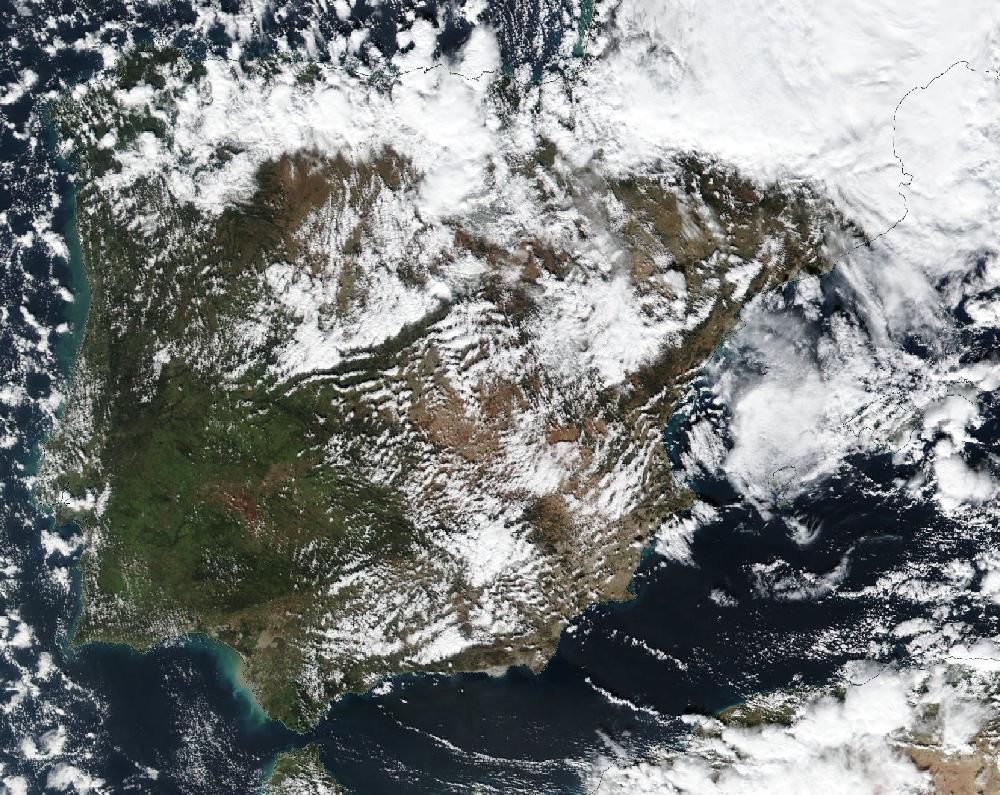
Storm Helena: wind and snow across much of Spain, 1–3 February 2019
1 February 2019 to 3 February 2019. Updated 26 October 2026.
It coincides with storm Gabriel, named by Météo-France on 28 January 2019. AEMET named this storm Helena on 30 January 2019.
Over 3 days, 55 of Spain's 182 warning zones had an orange or red warning for wind and snow: 76 zone-days at orange or red, 0 of them red. The day with the most zones at orange or red was 2 February, with 41 zones.
2 February was the day with the most people in zones under an orange or red warning: 4.7 million people live there (INE municipal register, 2025).
How it compares
- It is number 48 of 119 episodes since June 2018 by zone-days at orange or red.
- Among the 26 wind episodes, it is number 9.
- Until then, no wind episode in the archive had been this widespread.
Day by day
| Day | Red | Orange | Yellow | Orange or red warnings for |
|---|---|---|---|---|
| Fri 1 February | — | 20 | 107 | wind, snow |
| Sat 2 February | — | 41 | 59 | snow, wind |
| Sun 3 February | — | 15 | 38 | wind, snow |
Zones with a warning each day, at their highest level that day.
The zones
And 106 more zones with yellow warnings only.
What AEMET's stations measured
The most measured in the zones with an orange or red warning, on their warning days: a 136 km/h gust at Fisterra (Oeste de A Coruña) on 1 February; a low of -11.4 °C at Sant Maurici (llac) (Pirineo de Lleida) on 3 February.
| Zone | Strongest gust | Lowest temperature |
|---|---|---|
| Oeste de A Coruña | 136 km/h Fisterra · 1 February | 3.1 °C Vimianzo · 1 February |
| Interior norte de Castellón | 134 km/h La Pobla de Benifassà-Fredes · 2 February | -3.2 °C Villafranca del Cid/vilafranca · 3 February |
| Cordillera Cantábrica de León | 128 km/h Puerto de San Isidro · 1 February | -9.5 °C Puerto de San Isidro · 3 February |
| Interior sur de Castellón | 122 km/h Atzeneta del Maestrat · 3 February | 2.6 °C Montanejos · 3 February |
| Ampurdán | 121 km/h Espolla · 3 February | 4.7 °C Espolla 'Les Alberes' · 3 February |
| Noroeste de A Coruña | 117 km/h Estaca de Bares · 1 February | 4.2 °C A Coruña Aeropuerto · 1 February |
| Pirineo de Girona | 114 km/h Maçanet de Cabrenys · 3 February | -9.1 °C La Molina · 3 February |
| Centro y valle de Villaverde | 112 km/h Alto Campoo · 2 February | -6.2 °C Alto Campoo · 2 February |
| Bajo Aragón de Teruel | 111 km/h Andorra, Horcallana · 2 February | -0.8 °C Andorra, Horcallana · 3 February |
| Prelitoral sur de Tarragona | 108 km/h Estación de Tortosa (roquetes) · 2 February | 1.1 °C Cabacés · 3 February |
| Gúdar y Maestrazgo | 107 km/h Mosqueruela · 3 February | -6.4 °C Mosqueruela · 3 February |
| Poniente y Almería Capital | 107 km/h Láujar de Andarax · 1 February | -1.8 °C Láujar de Andarax · 2 February |
| Pirineo oscense | 105 km/h Torla - Ordesa · 3 February | -6.5 °C Biescas, Embalse de Búbal · 3 February |
| Ribera del Ebro de Zaragoza | 104 km/h Caspe, Plana del Pilón · 2 February | 0.7 °C Leciñena · 3 February |
| Valle del Almanzora y Los Vélez | 102 km/h Albox · 1 February | -1.1 °C Vélez Blanco - Topares · 2 February |
| Litoral sur de Castellón | 100 km/h Torreblanca · 3 February | 6.9 °C Torreblanca · 3 February |
| Litoral sur de Tarragona | 97 km/h Vandellòs · 2 February | 4.0 °C Vandellòs · 3 February |
| Cordillera Cantábrica de Palencia | 96 km/h Velilla del Río Carrión, Camporredondo de Alba · 1 February | -6.5 °C Velilla del Río Carrión, Camporredondo de Alba · 3 February |
| Depresión central de Tarragona | 96 km/h La Pobla de Massaluca · 2 February | 0.1 °C Horta de Sant Joan · 3 February |
| Sur de Huesca | 96 km/h Lanaja · 2 February | 1.4 °C Lanaja · 2 February |
And 34 more zones with an orange or red warning.
For each zone, the highest value its AEMET stations measured on the episode's warning days (the lowest, for the low temperature), with the station and the day. Rain from 07:00 to 07:00 UTC; gust: the day's strongest. It is what the zone's stations measured, not every town, and a measurement, like a warning, is not damage.
How AEMET's warnings unfolded
The orange warning reached 76 zone-days. AEMET issued it ahead of time in 74 of them (median: 35 h) and for the current hour in the other 2: warnings are also raised as things unfold. The first warning of any level for those same days had come a median 12 h earlier.
| Zone | Day | First warning | Orange issued | For · notice |
|---|---|---|---|---|
| Cordillera Cantábrica de León | Fri 1 | Tue 29 Jan, 23:50 yellow | Wed 30 Jan, 11:52 | 00:00 · 36 h before |
| Montaña de Ourense | Fri 1 | Tue 29 Jan, 23:50 yellow | Wed 30 Jan, 11:52 | 00:00 · 36 h before |
| Sanabria | Fri 1 | Tue 29 Jan, 23:50 yellow | Wed 30 Jan, 11:52 | 00:00 · 36 h before |
| A Mariña | Fri 1 | Tue 29 Jan, 23:50 yellow | Wed 30 Jan, 23:06 | 04:00 · 29 h before |
| Centro de Lugo | Fri 1 | Wed 30 Jan, 11:52 yellow | Wed 30 Jan, 23:06 | 04:00 · 29 h before |
| Cordillera y Picos de Europa | Fri 1 | Tue 29 Jan, 23:50 yellow | Wed 30 Jan, 23:06 | 00:00 · 25 h before |
| Interior de A Coruña | Fri 1 | Wed 30 Jan, 11:52 yellow | Wed 30 Jan, 23:06 | 04:00 · 29 h before |
| Interior de Pontevedra | Fri 1 | Wed 30 Jan, 11:52 yellow | Wed 30 Jan, 23:06 | 04:00 · 29 h before |
| Miño de Pontevedra | Fri 1 | Wed 30 Jan, 11:52 yellow | Wed 30 Jan, 23:06 | 04:00 · 29 h before |
| Montaña de Lugo | Fri 1 | Tue 29 Jan, 23:50 yellow | Wed 30 Jan, 23:06 | 00:00 · 25 h before |
| Noroeste de A Coruña | Fri 1 | Tue 29 Jan, 23:50 yellow | Wed 30 Jan, 23:06 | 04:00 · 29 h before |
| Oeste de A Coruña | Fri 1 | Wed 30 Jan, 11:52 yellow | Wed 30 Jan, 23:06 | 04:00 · 29 h before |
| Rias Baixas | Fri 1 | Wed 30 Jan, 11:52 yellow | Wed 30 Jan, 23:06 | 04:00 · 29 h before |
| Sur de Lugo | Fri 1 | Wed 30 Jan, 11:52 yellow | Wed 30 Jan, 23:06 | 04:00 · 29 h before |
| Suroccidental asturiana | Fri 1 | Tue 29 Jan, 23:50 yellow | Wed 30 Jan, 23:06 | 00:00 · 25 h before |
And 61 more zone-days.
The full timeline: 113 changes at orange or red
Wed 30 January
- Cordillera Cantábrica de León: Raises the snow warning to orange: Friday 1, all day. 25 cm of snow in 24 h.
- Montaña de Ourense, Sanabria: Raises the snow warning to orange: Friday 1, all day. 20 cm of snow in 24 h.
- A Mariña, Centro de Lugo, Interior de A Coruña, Interior de Pontevedra, Miño de Pontevedra, Montaña de Lugo, Noroeste de A Coruña, Oeste de A Coruña, Rias Baixas, Sur de Lugo, Suroeste de A Coruña: Raises the wind warning to orange: Friday 1, 04:00–09:00. Gusts up to 100 km/h.
- Cordillera y Picos de Europa, Montaña de Lugo, Suroccidental asturiana: Raises the snow warning to orange: Friday 1, all day. 20 cm of snow in 24 h.
- Cordillera Cantábrica de León, Cordillera y Picos de Europa, Montaña de Lugo, Montaña de Ourense, Sanabria, Suroccidental asturiana: Issues a orange snow warning: Saturday 2, 00:00–12:00. 20 cm of snow in 24 h.
- Interior norte de Castellón, Litoral sur de Tarragona, Prelitoral sur de Tarragona: Issues a orange wind warning: Saturday 2, 12:00–24:00. Gusts up to 100 km/h.
Thu 31 January
- Poniente y Almería Capital: Raises the wind warning to orange: Friday 1, 00:00–12:00. Gusts up to 90 km/h.
- Centro y valle de Villaverde, Llanada alavesa: Raises the snow warning to orange: Saturday 2, all day. 8 cm of snow in 24 h.
- Cordillera Cantábrica de León, Cordillera y Picos de Europa, Suroccidental asturiana: Extends the orange snow warning: now until 24:00 on Saturday 2. 30 cm of snow in 24 h.
- Depresión central de Tarragona, Interior sur de Castellón, Litoral norte de Castellón: Raises the wind warning to orange: Saturday 2, 08:00–24:00. Gusts up to 100 km/h.
- Gúdar y Maestrazgo: Raises the wind warning to orange: Saturday 2, 10:00–24:00. Gusts up to 100 km/h.
- Interior norte de Castellón, Litoral sur de Tarragona, Prelitoral sur de Tarragona: Brings the orange wind warning forward: now from 08:00 on Saturday 2. Gusts up to 100 km/h.
- Pirineo de Lleida, Pirineo oscense, Valle de Arán: Raises the wind warning to orange: Saturday 2, 12:00–24:00. Gusts up to 100 km/h.
- Pirineo navarro, Pirineo oscense: Raises the snow warning to orange: Saturday 2, all day. 20 cm of snow in 24 h.
- Valle de Arán: Raises the snow warning to orange: Saturday 2, 10:00–24:00. 20 cm of snow in 24 h.
- A Mariña, Miño de Pontevedra, Noroeste de A Coruña, Oeste de A Coruña, Rias Baixas, Suroeste de A Coruña: Brings the orange wind warning forward: now from 00:00 on Friday 1. Gusts up to 110 km/h.
- Central y Valles Mineros: Issues a orange snow warning: Friday 1, 12:00–24:00. 8 cm of snow in 24 h.
- Centro de Lugo, Interior de A Coruña, Interior de Pontevedra, Montaña de Lugo, Sur de Lugo: Brings the orange wind warning forward: now from 00:00 on Friday 1. Gusts up to 100 km/h.
- Bajo Aragón de Teruel, Ribera del Ebro de Zaragoza, Sur de Huesca: Raises the wind warning to orange: Saturday 2, 10:00–21:00. Gusts up to 90 km/h.
- Central y Valles Mineros: Issues a orange snow warning: Saturday 2, all day. 8 cm of snow in 24 h.
- Centro de Navarra, Gipuzkoa interior: Raises the snow warning to orange: Saturday 2, all day. 5 cm of snow in 24 h.
- Condado de Treviño, Norte de Burgos: Raises the snow warning to orange: Saturday 2, all day. 8 cm of snow in 24 h.
- Cuenca del Nervión, Rioja alavesa: Issues a orange snow warning: Saturday 2, all day. 5 cm of snow in 24 h.
- Pirineo navarro: Issues a orange wind warning: Saturday 2, 12:00–18:00. Gusts up to 100 km/h.
- Depresión central de Tarragona, Litoral sur de Tarragona, Prelitoral sur de Tarragona: Issues a orange wind warning: Sunday 3, 00:00–20:00. Gusts up to 100 km/h.
- Interior norte de Castellón, Interior sur de Castellón, Litoral norte de Castellón, Pirineo de Girona, Pirineo de Lleida, Pirineo oscense, Prepirineo de Barcelona, Valle de Arán: Issues a orange wind warning: Sunday 3, all day. Gusts up to 100 km/h.
Fri 1 February
- Liébana: Raises the snow warning to orange: Friday 1, 22:00–24:00. 20 cm of snow in 24 h.
- Liébana: Raises the snow warning to orange: Saturday 2, all day. 20 cm of snow in 24 h.
- Vertiente cantábrica de Navarra: Issues a orange snow warning: Saturday 2, all day. 5 cm of snow in 24 h.
- Cordillera Cantábrica de Burgos, Cordillera Cantábrica de Palencia: Raises the snow warning to orange: Saturday 2, all day. 20 cm of snow in 24 h.
- Sanabria: Lowers the snow warning to yellow: Saturday 2, 00:00–12:00. 10 cm of snow in 24 h.
- Cazorla y Segura: Raises the snow warning to orange: Saturday 2, 00:00–06:00. 20 cm of snow in 24 h.
- Condado de Treviño, Norte de Burgos: Issues a orange snow warning: Sunday 3, 00:00–06:00. 8 cm of snow in 24 h.
- Cordillera Cantábrica de Burgos: Issues a orange snow warning: Sunday 3, 00:00–06:00. 20 cm of snow in 24 h.
- Nacimiento y Campo de Tabernas, Valle del Almanzora y Los Vélez: Raises the wind warning to orange: Saturday 2, 00:00–18:00. Gusts up to 90 km/h.
- Altiplano de Murcia, Noroeste de Murcia: Raises the wind warning to orange: Saturday 2, 07:00–17:00. Gusts up to 90 km/h.
- Norte de Burgos: Issues a orange snow warning: Friday 1, 22:00–24:00. 8 cm of snow in 24 h.
- Interior de Alicante, Interior sur de Valencia: Raises the wind warning to orange: Saturday 2, 09:00–20:00. Gusts up to 90 km/h.
- Litoral sur de Castellón: Raises the wind warning to orange: Saturday 2, 08:00–24:00. Gusts up to 90 km/h.
- Pirineo navarro: Brings the orange wind warning forward: now from 09:00 on Saturday 2. Gusts up to 100 km/h.
- Condado de Treviño, Norte de Burgos: Lowers the snow warning to yellow: Sunday 3, 00:00–06:00. 3 cm of snow in 24 h.
- Cordillera Cantábrica de Burgos: Lowers the snow warning to yellow: Sunday 3, 00:00–06:00. 8 cm of snow in 24 h.
- Depresión central de Tarragona: Shortens the orange wind warning: now until 10:00 on Sunday 3. Gusts up to 100 km/h.
- Interior norte de Castellón, Interior sur de Castellón, Litoral norte de Castellón: Shortens the orange wind warning: now until 16:00 on Sunday 3. Gusts up to 100 km/h.
- Litoral sur de Tarragona, Prelitoral sur de Tarragona: Shortens the orange wind warning: now until 06:00 on Sunday 3. Gusts up to 100 km/h.
- Pirineo de Girona, Pirineo de Lleida, Pirineo oscense, Prepirineo de Barcelona, Valle de Arán: Shortens the orange wind warning: now until 15:00 on Sunday 3. Gusts up to 100 km/h.
Sun 3 February
- Ampurdán: Raises the wind warning to orange: Sunday 3, 10:00–24:00. Gusts up to 100 km/h.
AEMET's issue times, in mainland Spain time (Canary Islands in island time). Notice is the time from issue to the first hour the warning covered; a warning issued “for the current hour” runs from the hour it is published.
What this says and what it doesn't
A warning is an AEMET forecast, not a measurement or a damage report: it says a threshold is expected to be exceeded in a zone. A warning is not damage; a zone is not a building.
A zone-day is one warning zone with a warning on one day. Ten zones at orange on the same day make ten zone-days. A day with several warnings in one zone counts once, at its highest level.
Each zone has its own thresholds, so an orange heat warning in Asturias doesn't mean the same temperature as in Córdoba. More in how warnings work.
To cite: “Climaviso, from AEMET warnings”.
Source: official AEMET warnings, collected by Climaviso since June 2018.
← Previous episode · All episodes · Next episode → · 2019 warnings review